
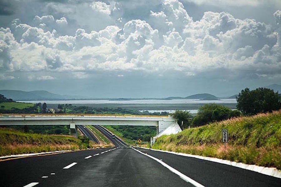
Pátzcuaro is located in west-central Michoacán, between Morelia and Uruapan, near the Lake Region and connected by road with central Mexico, the Bajío and western Mexico.
The city stands at 2,140 metres above sea level. You can feel the altitude: even after a mild day, mornings and evenings can be cool.
Pátzcuaro is relatively easy to reach by car or bus. If you are coming from farther away, the airports in Morelia and Uruapan provide two different gateways to the region.
Llegar en automóvil
Pátzcuaro está bien comunicado por la red carretera de Michoacán.
If you are coming from Mexico City, Querétaro, León, the Bajío or points farther north,the Cuitzeo–Pátzcuaro Motorway / Morelia Bypass connects with Pátzcuaro without requiring you to drive through Morelia’s urban area. It is one of the main road approaches to the region.
From Uruapan and western Michoacán, the Pátzcuaro–Uruapan highway forms part of the corridor connecting the two cities.
From Guadalajara, Mexico City to Pátzcuaro. and other parts of the country, several routes are possible depending on your exact point of departure, the roads you choose and conditions that day.
For that reason, we prefer not to give you a fixed travel time that may be different tomorrow.
Before setting out, check an up-to-date navigation app. If you want to calculate distances, tolls and possible routes, you can also use Traza tu Ruta, the route-planning tool provided by Mexico’s Secretariat of Infrastructure, Communications and Transport.
Distances That Help You Get Your Bearings
As a geographical reference, Morelia and Uruapan are the two nearest major cities, and Pátzcuaro lies along the corridor connecting them.
Actual driving times can change because of traffic, roadworks, weather, stops and the type of road used. For a long journey, always calculate your route on the day you travel or shortly beforehand.
Getting Here by Bus
Pátzcuaro has an important advantage: it is not simply the end of a route, but a regional transit and connection point..
The Morelia–Pátzcuaro–Uruapan corridor has frequent service throughout the day. Autobuses Purhépechas and Servicios Coordinados, among other companies, operate along this route; some services run between Morelia and Uruapan with a stop in Pátzcuaro, while there are also direct services between Morelia and Pátzcuaro.
Autobuses Purhépechas maintains a presence at the bus stations in Morelia, Pátzcuaro y Uruapan, reflecting the regional continuity of its service.
Alongside these regional buses, Pátzcuaro also receives first-class services and has connections with other destinations.
From Mexico City
There are direct bus services from Mexico City to Pátzcuaro..
The departure terminal, number of services and schedules depend on the company and the day of travel, so it is best to check before making your way to the bus station.
If you cannot find a convenient direct service, Morelia is an easy connection: numerous regional buses continue from its bus terminal to Pátzcuaro. Morelia es una conexión sencilla: desde su terminal continúan numerosos servicios regionales hacia Pátzcuaro.
From Morelia
The Morelia–Pátzcuaro connection is one of the most common routes.
There is an important distinction to make here: online ticket platforms show only part of the available service. First-class buses are supplemented by regional companies —including Purhépechas and Servicios Coordinados— so the actual frequency along the corridor is greater than what appears when searching only one company.
We do not give a fixed interval because schedules change. If you arrive at Morelia’s bus terminal, ask for the next departure to Pátzcuaro.
From Uruapan
There is also frequent service in the Uruapan–Pátzcuaro direction..
Many regional buses continuing toward Morelia stop in Pátzcuaro. Autobuses Purhépechas maintains offices in Uruapan, Pátzcuaro and Morelia.
The same applies here as from Morelia: information available online does not always reflect every regular service actually operating.
If you are travelling by bus, confirm schedules and the last departure on the day of travel.
Getting Here by Air
If you are flying to Pátzcuaro, it is worth considering two airports.
They are not equivalent: Uruapan is closer to Pátzcuaro, while Morelia offers a much broader flight network.
Uruapan International Airport — UPN
El General Ignacio López Rayón International Airport in Uruapan is the airport geographically closest to Pátzcuaro.
In 2026, it once again has regular commercial flights. Its range of services is smaller than Morelia’s, and routes and frequencies may change, so it is worth checking whether a suitable flight is available for your travel dates.
During 2026, connections with AIFA, have operated alongside other air services; schedules should not be regarded as permanent and should be confirmed directly with the airline.
If the flight works for your point of origin and travel dates, If the flight works for your point of origin and travel dates,.
Morelia International Airport — MLM
El General Francisco J. Mújica International Airport in Morelia is located in the municipality of Álvaro Obregón, northeast of Morelia.
It is the air gateway with the widest range of domestic and international connections for reaching this part of Michoacán. In 2026, it continues to offer a substantial network of routes served by several commercial airlines.
From the airport, you can take an authorised taxi or rent a car. Another option is to travel first to Morelia’s bus terminal and continue from there to Pátzcuaro.
We do not publish a fixed list of airlines, destinations or frequencies because they change. Before booking or beginning your journey, check directly with the airport and your airline.
Reaching Pátzcuaro Means Entering the Region
Pátzcuaro may be your destination, but it is also a good starting point for exploring the Pátzcuaro Region.
From here, roads lead toward Tzintzuntzan, Quiroga, the communities and islands of the lake, Santa Clara del Cobre, Zirahuén and other towns throughout the region.
By car, an up-to-date navigation app is usually enough to handle many of these journeys.
Regional public transport works differently: buses, combis and local services connect many communities, but schedules, departure points and frequencies are not always accurately shown online.
If you are travelling to a specific community, ask before setting out about the current service and the exact place where you should board it.
Visit Pátzcuaro will continue gathering this information in the corresponding territorial entries and routes, without turning variable information into permanent facts.
Before You Travel
Pátzcuaro stands at 2,140 metres above sea level, so a light jacket, sweater or extra layer is often useful even during mild weather.
During the rainy season, check the forecast and road conditions, particularly if you plan to travel along secondary roads or into communities throughout the region.
And one simple recommendation: do not rely on a timetable you found online months ago. For buses, flights, roads and regional transport services, always confirm the most recent information before setting out.
 EN
EN  ES
ES